-

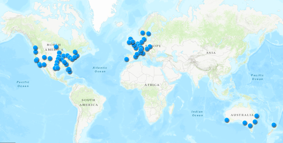
- United States tour locations
-

- Europe tour locations
-

- Australia and New Zealand tour locations
For my mapping assignment, I chose to map Shawn Mendes’ tour locations because I love Shawn Mendes and was curious about what all his tour locations would look like on a world map. There are a few things I want to comment on regarding my experience mapping these locations on ArcGIS. I attached screenshots above, but you can view the interactive map on ArcGIS here.
Breadth of data inputted on ArcGIS
I expected it to be relatively simple to map all of these locations since Mendes has all his tour locations, with each location’s respective venue, on a single webpage. However, as I was doing the assignment, I realized this came with the assumption that ArcGIS would be similar to Google Maps and just be able to match a venue’s name with its respective location on the map.
For the most part, I tried to construct the map using the names of the venues because that was more convenient, given the webpage already had each venue’s name next to the tour dates, so I wouldn’t need to open too many new webpages. I didn’t run into too many problems while doing this for the venues in the United States — aside from the fact that multiple venues across the United States have the same name, which was easily solved by lining up the venue name with the correct city/state. International tour locations were much trickier… I guess ArcGIS might have less data for locations outside of the United States? It was also somewhat confusing for some venues that had multiple addresses on ArcGIS; I believe this was occasionally the case because all of these venues are rather large, and the differences in these addresses may have represented different parts of the roads or intersections that these venues occupy.
Using venue names as opposed to “more precise” addresses
When ArcGIS was unable to recognize a venue name (as I pointed out, this was mainly the case for international locations), I decided to take an extra step to get these locations on the map. This just involved going on the RSVP page of the respective event or using Google to find the specific address of the venue. That made me wonder whether I was actually messing up the preciseness of my map by mostly using the venue names, as opposed to addresses, to pinpoint locations on ArcGIS. Of course, I began regretting not opting for route of using the “more precise” addresses once I ran into the problem of a venue having numerous addresses on ArcGIS.
Are the locations that are attached to these venue names, the same as the venues’ actual addresses? That depends on the inner mechanics of ArcGIS, so I don’t have a concrete answer to that question.
Layers on ArcGIS
I’m not entirely sure why this happened, but my map is composed of two layers, “Map Notes” and “Map Notes 1.” That was not what I intended to happen; I didn’t want any layers at all, and I didn’t try to build the map around layers. I do believe that this somehow happened because I didn’t make the map all at once; I saved the map to save my progress at some point and then continued my progress a little while later. (When I tried to save the map again after resuming and finishing my work, I actually had to rename the map because it couldn’t save my new progress to the map that was made from the initial “save.”) It’s more of an inconvenience if anything, since I don’t want anyone looking at my map to go to the “Contents” tab and think the two different layers actually mean anything.
Moving further with more time and more familiarity with ArcGIS
Though I ran into this “layer” problem, I do see some ways it could be helpful to use layers. For example, I could’ve used different layers to map out Mendes’ tour locations in a specific month (i.e. one layer for April, one for May, and so on).
I also thought it would’ve added an even greater visual element to draw arrows to map out Mendes’ tour from location to location. The map I created is just a bunch of dots on a map with no context, and the context could’ve been improved if there were arrows drawn from location to location and/or layers to separate out tour locations by month.
Fun project!
Re: Layer Problem
That’s exactly what happened. Every time you quit and come back, it will start a new set of map notes.
You can choose the original set.
I used the map notes thing to help organize mine: each category got its own “map notes”.
__________
As far as the tour dates thing goes… you can change the color and shape of the dots. That might help. You can also edit the dots iso that when someone clicks on them information pops up.
Thanks Sean! I’ll have to experiment more to get the layer problem down. 🙂
I experimented with colors for a different map I had started prior to submitting this one, and I had used it for the purpose of distinguishing dates (years to be exact) as well. Also had added descriptions of the dots for that map. Completely forgot I had did both those things. Your tips are helpful though!
I didn’t figure out the map notes thing until my third try because I’m dense that way sometimes. You can also rename “map notes”, which helped me organize.
Nice job, Sandy! I haven’t started my project yet, but it seems possible to import layers from Google maps into ArcGIS. I have no idea whether matching up venue names with their locations is easier in Google maps, and whether the data has equal precision to inputting the addresses yourself (as you mention) but if so, that seems like a good option.
Anyway, thank you for making your process so clear and transparent!
Thanks Rob! If you decide to use ArcGIS, I hope you’ll be able to get around the problems I encountered.
It might just be my assumption that matching up venue names with their locations is easier in Google Maps since I often use Google Maps for directions and (more often than not) put in the name of a location instead of the location’s address. I’m not sure how different/far apart the data on Google Maps is from ArcGIS, but that might be something I’ll try exploring eventually.
Sandy, your mapping project is a good example of what Ramsey’s screwmeneutics article was about. I wasn’t very aware of Shawn Mendes before reading your post, but now I’ve been listening to him all morning. This is the kind of unpredictable result that can happen when two different minds engage with each other.
Glad to hear that I’ve inspired at least one person to listen to Shawn Mendes’ music from this post! Does you listening to him all morning mean you enjoy his music?
Yes, I did enjoy it. I recognize a few of his songs, actually. I probably picked them up from various radios over the years.
Hi Sandy: thanks for the great post! It’s so much fun to look at it. I really appreciate the way you address the problems you encountered during this project. As for the precise address of the venue vs the venue name, it became a question in my project too. I use the venue names for story building as it feels cultural and historical but I felt like finding the exact addresses of the venues also for the accuracy & the relation to the current city shapes so I just google old (yet digitized) newspapers about them. In my case, the venues disappeared (as I deal with older Manhattan) so I should search harder. Often, I get only approximate addresses also like the corner of intersecting streets. It doesn’t look like ArcGIS internally has that historical information about the streets, (am I expecting too much, maybe? :/) so it’s an interesting research externally I should pursue and merge it to the ArcGIS afterwards 🙂 Thanks again for sharing your work ahead of the others.